Geology of Redmire
Sedimentary surface rocks
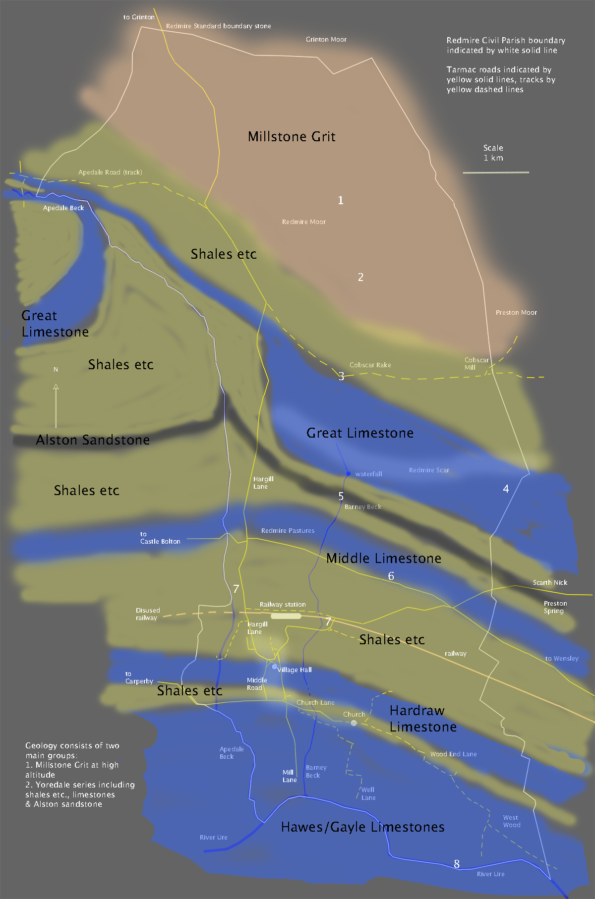
Click here for GEOLOGY MAP at the foot of this page. Numbers in headings below are indicated on geology map and refer to locations of rock samples illustrated.
The geology of Wensleydale was formed in a tropical region, with warm, shallow seas, during the Carboniferous Period, between 359 to 299 million years ago. Continental drift has moved the land steadily northwards and other events such as uplift, glaciation and erosion have contributed to the landscape we see today. The rocks are sedimentary and banded. Each band represents part of a recurring cycle of events, in the sequence of deposition in a shallow sea (limestone), mud deposits as the sea became shallower (shale), sand deposits from a river delta (sandstone) then swampy forest (coal). In this way, the land rose slightly above sea level. The sequence was repeated several times as sea levels rose. The rocks formed are known as the Yoredale Group, after the old name for Wensleydale. Capping all this is a thick layer of Millstone Grit, deposited after the Yoredale Group. Millstone Grit is a mix of sandstones, siltstones and interbedded mudstones with thin coals, deposited by river deltas. The full sequence of rocks can be seen on higher ground further west, particularly on Ingleborough. The rock bands vary in resistance to erosion by glaciation and liquid water, resulting in a stepped appearance to the valley sides, seen best further up Wensleydale from Redmire, to the west. The pattern has been complicated by faulting, leading to the introduction of lead veins. The full sequence of rocks, seen further west, is reduced at the Redmire end of Wensleydale and is limited to elements of the Yordale Group and the Millstone Grit capping. Redmire has historic coal, lead and limestone industries. Limestone continues to be quarried in the adjacent Wensley Quarry.
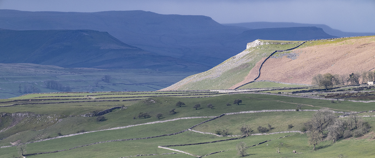
Stepped appearance of the landscape of Wensleydale, looking west from Redmire Scar.
Working down from Redmire Moor to the River Ure, over 4 kilometres and a drop of about 320 metres, we pass through a sequence, from youngest rocks on the moor to oldest in the river bed. They are, in order of descending altitude and increasing age, Millstone Grit and then the Yordale Group in the following bands; Shales, Great Limestone (Redmire Quarry), Shales, Alston Sandstone, Shales, Middle Limestone, Shales, Hardraw Limestone (under the southern part of the village but not visible), Shales, then finally Hawes/Gayle limestones exposed on the river bed. These names cover a great deal of variation over very short distances. Fossils are most evident as plant remains in the coal and as bodies and shells of marine animals, principally Crinoids and Brachiopods, in the limestone. However, some limestone samples reveal no visible fossils, and fossils in Redmire are generally very small.
1. Millstone Grit
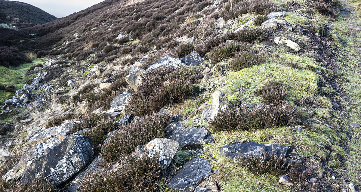
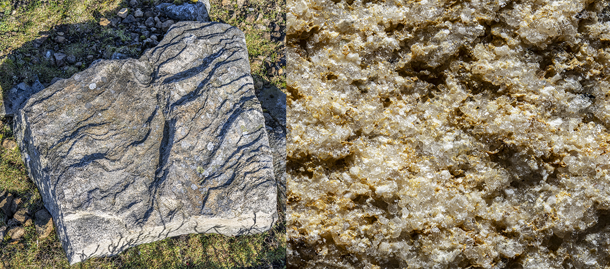
Stony Bank, Redmire Moor. Top photo shows a Gritstone landscape with heather clad, Calluna vulgaris, acidic soils. Below left, ripples set in the Millstone Grit at its formation. Below right, coarse, gritty texture of the rock, rich in quartz crystals. This type of stone was traditionally used for making Millstones for grinding flour, hence its name. It also makes a good, hard wearing, building and walling stone. Millstone Grit provides the hard, erosion resistant caps to the Wensleydale hills, charateristically flat topped escarpments such as Penhill.
2. Coal
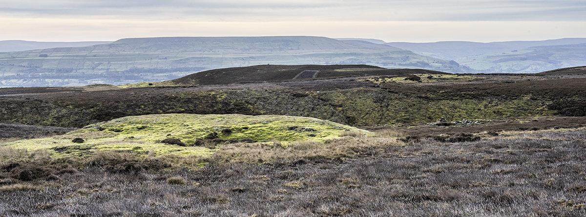
Redmire Moor. Top photo shows Penhill in the background, Tewit How, middle ground, and a coal shaft in the foreground. Below, fossil plants in a coal sample taken from Tewit How, exposed by rabbit digging. This part of Redmire Moor was a part of the extensive Preston Moor colliery. The coal was used locally during the 16th-19th centuries, notably for the lead smelting industry, but is low quality and became unviable as the railways delivered better coal from the Durham coalfields. The general landscape is Millstone Grit with acidic soils and heather, Calluna vulgaris, today used as a grouse moor. Around the coal pits, heather is replaced by moss, giving the bright green colour.
3. Limestone and lead
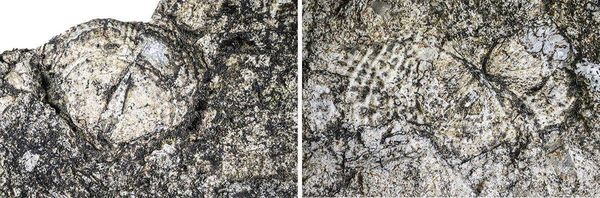
Cobscar Rake, Redmire Moor. Sample taken from the edge of the Great Limestone/shales. Left, complete Brachiopod shell. right, Brachiopods. Brachoipods are marine bivalve animals distinct from bivalve molluscs. Some species survive today, but they were much more numerous during the Carboniferous Period.
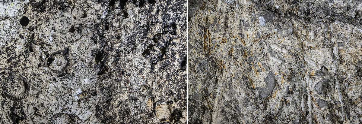
Cobscar Rake, Redmire Moor. Sample taken from the edge of the Great Limestone/shales. Left and right, Crinoids. Crinoids are stalked marine animals related to starfish and sea urchins Some species survive today.
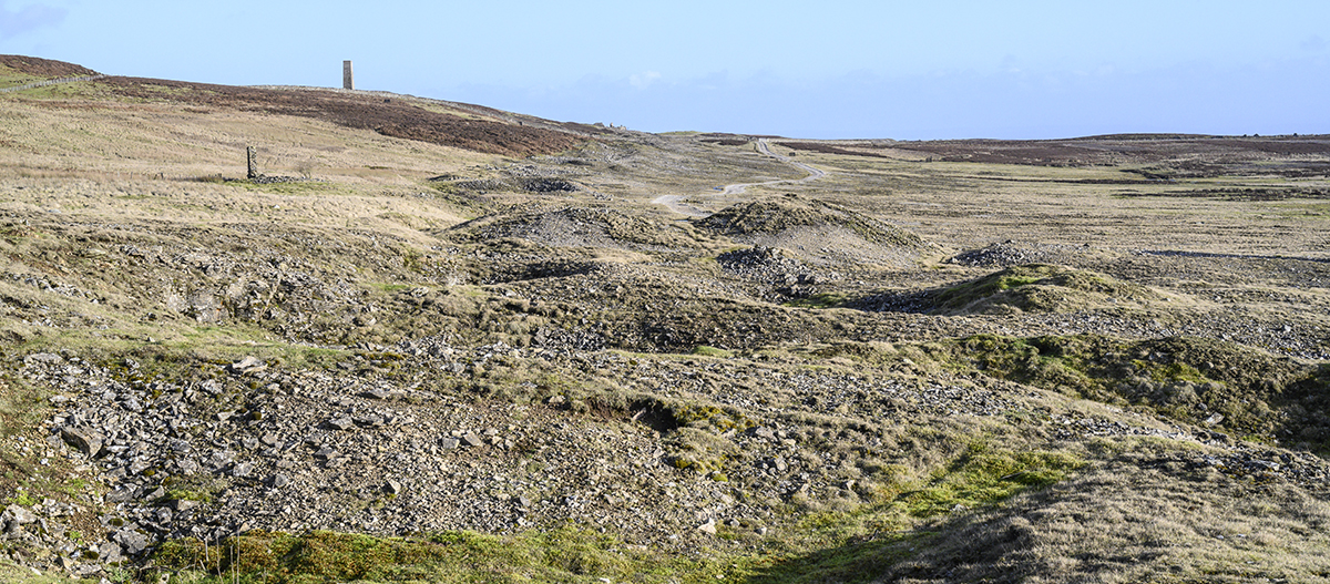
Below is a view along Cobscar Rake, with spoil heaps tracing out the line of the lead vein. The closer structure is the Calamine House and the far chimney belongs to Cobscar Lead Smelting Mill. To the left of the picture, the geology phases into mixed shales followed by Millstone Grit, with the Great Limestone to the right at a lower level. Soils here are generally alkaline, with acidic pockets. The two smaller photographs show furnace slag at the Calamine House.
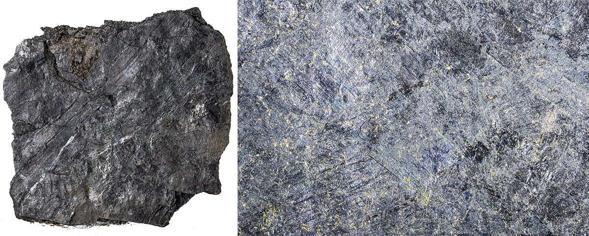
4. Great Limestone
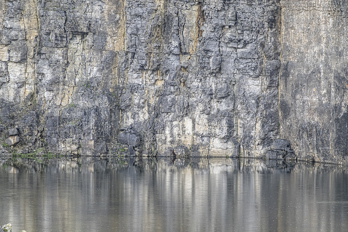
Redmire Quarry, Redmire Moor. Old quarry face showing Great Limestone. This is a hard, bluish rock quarried for roadstone and previously, for steel making on Teesside, with the Wensleydale Railway carrying the stone away. Redmire Quarry is now disused, but the adjacent Wensley Quarry still produces roadstone. Great Limestone is very dense, rich in calcite crystals, and low in fossils. The band is about 20 metres deep and forms the natural Redmire Scar along its southern edge. Soils are alkaline.
5. Alston Sandstone
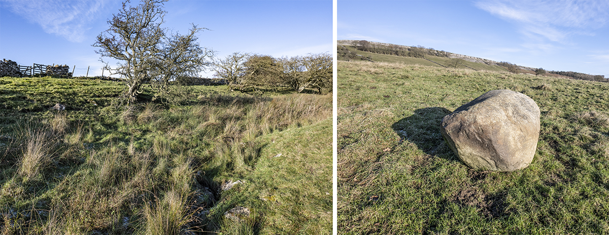
Redmire Pastures. This is a narrow band of sandstone, finer in texture than Millstone Grit.
6. Middle Limestone
Redmire Pastures. This is a narrow band of limestone with fossils. Alkaline soils supporting fine, sheep grazed tuf, and medieval terracing.
7. Shales etc
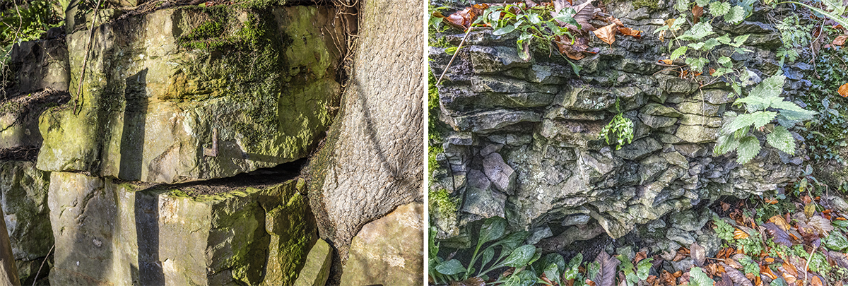
Several bands of rock are labelled Shales etc on the geology map. These are a varied mix of shales, sandstones and limestones, often showing different characteristics within a small area. Two examples are illustrated here. Left, sandstone type blocks in a small disused quarry just above the village adjacent to Apedale Beck. This rock appears to be similar to that used for building older cottages in the village. Right, on a similar level, more shale-like, fractured rocks in an old quarry adjecent to the railway bridge on the Wensley road.
Very little bedrock is visible at the level of the village, hidden by deeper glacial soils of an alkaline type. The lowest, in altitude, exposed rock band forms the bed of the River Ure, the southern boundary of Redmire Civil Parish.
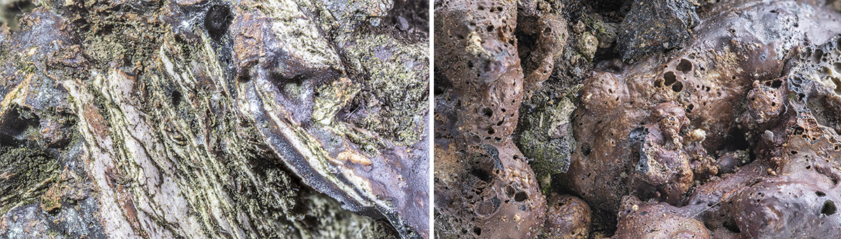
8. Hawes/Gayle Limestones
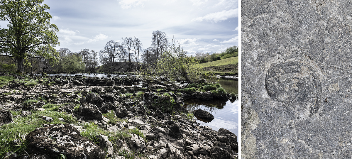
The limestone forming the bed of the River Ure is hard and dense, and provides the drop of a waterfall, Redmire Force, but that is outside the parish boundary. Here, the river bed at West Wood is illustratated. Right, a large fossil, in-situ. This rock is the oldest in the Redmire parish.
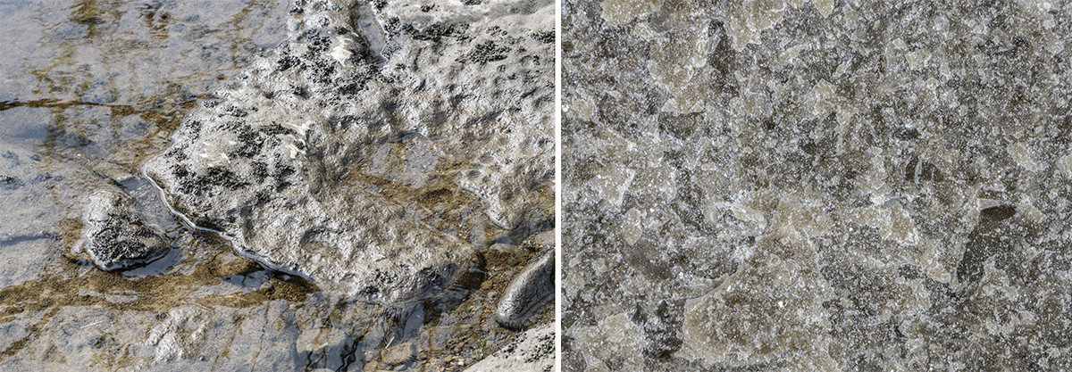
Below, left. Pitting caused by river erosion in the bedrock. Below, right. Crystalline structure of the rock.
Geology Map
Click here for TOP OF THIS PAGE : or here for MID page